
Natural Heritage
Natural heritage includes native plants and animals and the habitats they live in, geology, landscapes and seascapes. There are a number of diverse habitats found in County Clare.
Some habitats are of national importance and are recognised through designation as Natural Heritage Areas or proposed Natural Heritage Areas (pNHAs). Other habitats are of European Importance and are designated Special Areas of Conservation (SACs) for their habitat or plant/animal species value or Special Protection Areas (SPAs) for birdlife.
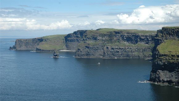
Cliffs of Moher (Clare Co Co)
What is natural heritage?
Biodiversity is a significant aspect of our natural heritage and relates to the wealth and diversity of all living things and the processes that give rise to these. To read more about biodiversity in County Clare visit our Biodiversity page.
More than 20% of County Clare is designated for nature conservation, with 47 Natura 2000 sites in the County, including 37 Special Areas of Conservation (SACs) and 10 Special Protection Areas (SPAs) designated for nature conservation. These are important at a European level, forming part of a European wide conservation network (Natura 2000 Network). There are 13 Natural Heritage Areas designated to protect areas of relatively intact peatland and 61 proposed Natural Heritage Areas. In addition, there is the Burren National Park, 5 Wildlife Sanctuaries and 4 Nature Reserves at Caher (Murphy) woodland, Ballyteigue, Dromore Woodland and Keelhilla (Slieve Carron). County Clare also has 45 recognised geological heritage sites.
Why does our natural heritage matter?
A wide range of economic and social benefits result from the protection of environmental quality and biodiversity. For example, biodiversity forms the basis of our landscapes, provides for food and clean water supplies, nutrient recycling and coastal protection. Natural Heritage sites provide crucial habitats to many important species in Clare, as well as protect rare ecological processes and stunning landscapes. They also contribute climate stability and human well-being.
Climate change and Clare’s natural heritage
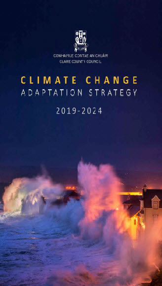
Climate change presents an immediate threat to our natural and built environments and to the ways of life which co-exist with these environments. To find out more about how Climate Change will affect County Clare as well as measures in place to for mitigation, please view the Clare County Council Climate Change Adaptation Strategy 2019-2024 [PDF, 3.77MB].
Species that are rare or in Ireland are vulnerable to the effects of climate change. The Lesser Horseshoe bats, as well as certain migratory birds and marine mammals (examples) are exposed. The drier summers and wetter winters will affect peat bogs and the resulting drying out may make them more susceptible to peat slides. Coastal and fresh waters are the most vulnerable to global climate change, with loss of water quality, and biodiversity. Wetland, blanket bog, rocky, gravel shores, shallow inlets and bays, estuaries and lagoons are also very susceptible to climate change in Ireland.
Sea level will have an impact on soft coastline, in particular the dune habitats of Bishops Quarter, Fanore, Lahinch, Spanishpoint, Quilty and Doonbeg. Salt marsh and other coastal wetlands are particularly vulnerable.
Nature based solutions
Nature-based solutions (NBS) are defined by the International Union for Conservation of Nature as “actions to protect, sustainably manage, and restore natural or modified ecosystems, that address societal challenges effectively and adaptively, simultaneously providing human well-being and biodiversity benefits”.
NBS are critical in climate change mitigation and adaptation and perform many important functions. They help to prevent flooding and erosion, regulate temperatures, absorb carbon and filter pollutants from the air. NBS are now embedded in council policy. For example, all tenders for the design of flood relief schemes in County Clare include a requirement for the consideration of NBS. In coastal areas, NBS include techniques to restore or enhance coastal sand dunes, such as marram planting and beach access management plans. Coastal solutions can also include mudflat restoration, and beach nourishment. These techniques aim to build resilience of ecosystems to extreme wave and storm surge events with minimal impacts to biodiversity. Some of these functions are:
- Vegetation, particularly trees through photosynthesis, sequesters and stores carbon as it grows, and can reduce air pollution through filtration
- During storm events with high winds, trees act as a natural barrier to reduce wind speed and provide shelter
- Plants in wetland areas attenuate, filtrate and purify water
- Trees and plants reduce water run-off in extreme rain events, taking pressure off the urban drainage system, they also prevent soil erosion
All of the above have the added value of providing recreational opportunities while building resilience to climate change.
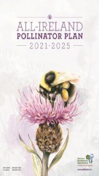
All-Ireland Pollinator Plan 2021-2025
Irish pollinators (insects; particularly bees and flies) are in decline. The problem is serious and requires immediate attention to ensure the sustainability of our food production, avoid additional economic impact on the agricultural sector, and protect the health of the environment. The All-Ireland Pollinator Plan 2021-2025 produced by the National Biodiversity Data Centre, aims to create an Ireland where pollinators can survive and thrive. The publication, Working Together for Biodiversity, explores what has been achieved through the All-Ireland Pollinator Plan.
The Burren National Park
The Burren National Park is located in the south-eastern corner of the Burren and is approximately 1500 hectares in size. The land was bought by the Irish Government for nature conservation and public access. It contains examples of all the major habitats within the Burren: limestone pavement, calcareous grassland, hazel scrub, ash/hazel woodland, turloughs, lakes, petrifying springs, cliffs and fen.
Coastal, marine and inland waterways
County Clare is located along the Wild Atlantic Way coastal route. With a diverse terrain extending from the rolling countryside to the rocky Atlantic coastline and stunning cliffs, the outer boundary of Clare’s western reaches, opens up a world of natural, ecological, and geological exploration. Take an opportunity to experience and enjoy the natural phenomena of the Clare coastline from Blackhead to Loophead and the Burren and Cliffs of Moher UNESCO Global Geopark.
Clare's coastline is the sixth longest in Ireland and there are approximately 100 islands off the Clare coast. It is a coastline of marked contrasts, with the low-lying Fergus and Shannon Estuaries, the Galway Bay coast and associated coastal wetlands, the dune systems of Carrowmore Marsh/White Strand and Fanore which contrast sharply with the rocky sea cliffs at the Cliffs of Moher and Loop Head. For a detailed assessment of how climate change could affect this see: Climate Change, Heritage and Tourism: Implications for Ireland’s Coast and Inland Waterways [PDF,6MB].
The Atlantic coast of Clare, sitting on the edge of Europe, is wild and remote and presents a rich and varied landscape and maritime heritage. Thirteen different Seascape types are described in the Clare Landscape Character Assessment[PDF, 11.96MB].
The Clare coast is represented by our coastal communities, coastal buildings, the many piers and harbours and navigation aids, including light houses along the coast, archaeology such as the amazing timber wattle fish traps in the Fergus Estuary from the 12th century, promontory and stone forts as well as Napoleonic and Martello towers. Fore more visit the Irish Martello Towers website.
The Shannon estuary
The Shannon estuary is home to a resident group of Bottlenose dolphins. The Irish Government declared the coastal waters off Ireland a whale and dolphin sanctuary in 1991. Since 1993, the Shannon Dolphin Project (Shannon Dolphin and Wildlife Foundation) has worked to develop and provide educational awareness and conservation of the Shannon dolphins and other wildlife in the region. For more information, read the Bottlenose Dolphin Survey in the Lower River Shannon [PDF,1.41MB].
Lough Derg
Lough Derg is Ireland's third largest lake after Lough Neagh and Lough Corrib. It is the southernmost of three lakes on the River Shannon. The river connects Lough Derg to the Grand Canal and Royal Canal via Shannon Harbour and Lough Ree respectively. Lough Derg covers an area of approximately 118 km2. It is characterised by broad bays, numerous islands and a complex indented shoreline of some 179 km. To optimise the conservation and use of the Lough Derg Region, Clare County Council announced a new visitor experience: Adventure Lough Derg.
Banner wetlands
With 120 miles of coastline and a number of estuaries (where a river meets the sea), Clare contains fresh water, salt water and even brackish water wetlands (mixture of fresh and salt water). Some of The Banner Wetlands are very rare elsewhere in Ireland and the rest of the World. In fact, Clare is home to some of the finest examples of calcareous fens, springs and turloughs found in Ireland and Northwest Europe.
County Clare Wetland Survey
The County Clare Wetlands Survey [PDF,16.6MB] 2008 found that he total wetland area in County Clare is estimated at 23,440 ha, this represents 7.4 % of the entire county. The study identified 34 wetland types (22 of which are listed in Annex 1 of the EU Habitats Directive, and nine of these are priority habitats) in County Clare. A total of 2069 discrete wetland habitat units have been collated and mapped, while information on 300 wetland sites and sub-sites has been recorded. In terms of the main habitat types in County Clare, the results suggest that on a county basis, the 23,440 ha of wetland recorded, cover the following percentage of the county: lakes 2.57%, bogs and wet heaths 2.52%, fens & flushes, marsh, reedbeds and reedbeds and wet grassland cover 1%, while 1% has been assigned to unknown wetland type awaiting more detailed habitat survey.
Invasive species
Invasive plants and animals are those that spread rapidly, often becoming dominant, and have a negative effect on the environment (both built and natural). Invasive species are often non-native; however, some native species can become invasive, especially when outside their normal range e.g., Gorse or Bracken. While the highlight is often on non-native invasive plants, equally other species such as Crayfish Plague and Australian Flatworm can cause devastating impacts to biodiversity in Clare. Negative effects caused by invasive species include structural damage, environmental degradation, aesthetic degradation, biodiversity loss, loss of land function, access restrictions and increased risk to human and animal health and safety. The principal Non Native Invasive Species affecting County Clare are Knotweeds, Giant Hogweed, Himalayan Balsam and Crayfish Plague
Invasive Species are expanding to compete with native flora and fauna. The impacts of IAS extend beyond biodiversity loss to include effects on ecosystem services, agricultural and fisheries production, and water quality and supply. IAS are one of the biggest threats to biodiversity in Clare with multiple invasive alien mammals, terrestrial and aquatic and invertebrates recorded in the county. This includes the now widespread Knotweeds. Clare County Council has established a baseline on IAS in Clare and developed a Draft County Level Strategy For Control [PDF,1.14MB]. Clare County Council also have an active programme of IAS eradication on their properties and along the public road network.
The National Invasive Species Database was created by the National Biodiversity Data Centre. Invasive Species Ireland has also compiled a list containing more than 30 of the most unwanted species in Ireland and Northern Ireland. You can find out about the individual species from the field guide to invasive species in Ireland booklet. A complete list of all invasive species in Ireland is available at the National Biodiversity Data Centre. Please also see the website Invasive Species Ireland for updates and Species Alerts. Any non-native invasive species should be recorded on the Biodiversity Data Centre (NBDC) Smartphone app which can be downloaded on any Smartphone from the National Biodiversity Data Centres website.
Invasive Species Ireland has produced biosecurity guidance in the form of Codes of Practice for key activities that are known to be facilitate the introduction of invasive species to Ireland and Northern Ireland.
Natural heritage legislation & best practice guidance
The National Parks and Wildlife Service is one of the primary stakeholders with responsibility for the protection of our Natural Heritage. The overall mandate of the NPWS is to preserve, protect and present our Natural Heritage
Ireland’s natural heritage is also protected by a range of local, national, European and global legislation. The NPWS is responsible for the enforcement of the Wildlife Acts 1978 to 2021. For example, it is an offence to cause the destruction or burning of vegetation on uncultivated land during the nesting and breeding season for birds and wildlife, from 1 March to 31 August. For this reason, all hedge cutting must be carried out between September 1st and the last day of February.
The below acts and directives have a significant bearing on our efforts to preserve the natural heritage of County Clare. As a result of positive legislation in recent decades, proposals for Planning and Development, must now be assessed for possible effects in relation to nature conservation.
- The Heritage Act, 1995
- European Communities (Birds and Natural Habitats) Regulations, 2011
Wildlife Act 1976 to 2021 - Birds Directive, 1979
- Habitats Directive, 1992
- European Communities (Birds and Natural Habitats) Regulations 2011 to 2021
- Whale Fisheries Act, 1937
- The Flora Protection Order, 1999
- Convention on Biological Diversity (Rio Convention), 1992
- Convention on the Wetlands of International Importance (Ramsar Convention), 1971
- Convention on the Conservation of Migratory Species of Wild Animals (Bonn Convention), 1993
- Convention on the Conservation of European Wildlife and Natural Habitats (Berne Convention), 1979
- UNESCO Convention for the Protection of the World Cultural and Natural Heritage (ratified 1992)
For more information on wildlife designations and the law go to National Parks and Wildlife Service.
Designated Sites
- NATURA 2000 is a network of nature protection areas in the territory of the European Union. The three main types of designation aimed at preserving our natural heritage are Natural Heritage Area (NHA), Special Area of Conservation (SAC) and Special Protection Area (SPA). Natural Heritage Areas are the primary National designation, and under the Wildlife Amendment Act (2000). In addition to the 13 sites listed as NHAs to protect peatlands in County Clare, there are currently 47 Natura 2000 sites in the county, as follows:
- 10 sites designated as SPAs in County Clare
- 37 sites listed as SACs in County Clare
Appropriate assessment
The Appropriate Assessment (AA) Requirements Of The Habitats Directive in respect of plans and projects are similar in many respects to the Environmental Impact Assessment (EIA) of projects, and the Strategic Environmental Assessment (SEA) of plans and programmes. However, the focus of AA is targeted specifically on Natura 2000 sites and their conservation objectives.
Green infrastructure
Green infrastructure is the interconnecting network of land and water all around us that sustains environmental quality and enriches the quality of our life.
Green infrastructure provides economic, educational, ecological and social benefits through natural solutions and help us to understand the advantages that nature can offer to society. Within County Clare opportunities exist to expand and strengthen the green infrastructure network and to explore the integration of green infrastructure in both public and private developments in the future. Find out more about Green Infrastructure and Biodiversity.
County Clare natural heritage projects
Under previous County Clare Heritage Plan projects, there have been multiple actions delivered, which have led to enduringly positive impacts on our natural heritage. For example, the Shannon Town Green Infrastructure and Design Guide [PDF,135.67MB] led to a focus on key green infrastructure areas and their interconnecting green corridors in Shannon Town.
The Loop Head Heritage Trail project involved the production and recording of heritage (including built, natural and cultural heritage) information and interpretation on the Wild Atlantic Way in Kilkee and Loop Head.
Wildfowl sanctuaries
Wildfowl sanctuaries are areas that have been excluded from the ‘Open Season Order’ so that game birds can rest and feed undisturbed. There are 68 sanctuaries in the State. Shooting of game birds is not allowed in these sanctuaries. There are five wildfowl sanctuaries in County Clare at Mutton Island, Islandavanna, Tullagher Lough, Ballyallia Lough and Inagh River (part of). For more information please view the National Parks and Wildlife Service website.
Nature Reserves
Nature Reserves are areas of importance to wildlife, that are protected under Ministerial order. Some are owned by organisations or private landowners, and persons interested in acquiring statutory protection for their lands can seek advice on this matter from the Department. There are four Statutory Nature Reserves in County Clare at Ballyteigue, Caher Murphy, Dromore and Keelhilla (Slieve Carron). To find out more visit the National Parks and Wildlife Service website.
Habitat surveys carried out by Clare County Council
A range of habitat surveys have been undertaken under the Clare Heritage Officer Programme across county Clare. The findings are being used to safeguard areas that have ecological value and will assist with the future planning policy and development of this area of County Clare. The findings of the surveys are provided below:
- Survey and Mapping of Habitats in Mid Clare [PDF, 40MB]
The geological heritage of Clare
County Clare is famous for its beauty and scenery, with an international reputation for the treasured landscapes such as the Burren and the Cliffs of Moher. The county has three distinct geological areas, all significant and important in international terms; East Clare with its ancient upland rocks, north Clare (the Burren) and West Clare (coast and shales). County Clare commissioned An Audit of County Geological Sites in Clare [PDF,41.63MB] in 2005. The publication the Banner Rocks - The Geological Heritage of Co. Clare [PDF,5.33MB] was based on this report and provides a user-friendly summary of Clare’s geological heritage. In addition see Appendix 3 of the Clare County Development Plan 2017-2023: Volume 1- Written Statement [PDF,225KB] for a list of Geological Heritage sites in Clare.
Landscape character assessment of Co. Clare
The Clare Landscape Character Assessment [PDF,11.93MB] sought to analyse the character, value, and sensitivity of landscapes identified within County Clare. By understanding how different landscapes developed and evolved from both a natural and social perspective, informed decisions relating to the management and planning of the landscape are enabled. Safeguarding and enhancing landscape character and sustaining a sense of place is an important planning objective. Guidelines for Incorporating Landscape Features into Development [PDF,523KB] was produced to provide an approach to the development of land that takes into account the values and functions of the natural environment and its landscape.
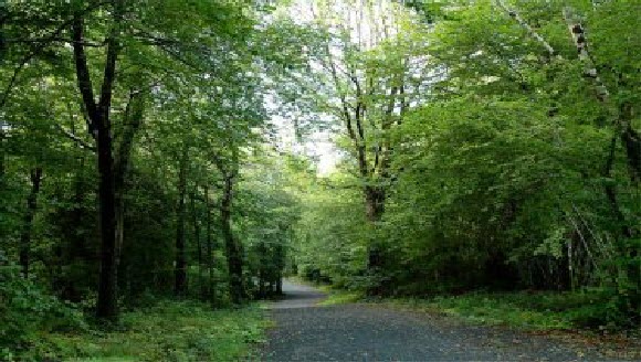
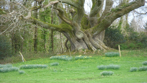
The Trees of County Clare
|
Brian Ború Oak, Tuamgraney |
The trees of County Clare are of tremendous value for both ecological, historic and folkloric reason, as well as providing amenity. Since, 1985, the Tree Council of Ireland, has sought to promote the planting, care and conservation of trees. Clare County Council undertook a Survey Of Trees In Towns And Villages of County Clare [PDF,19.53MB], in order to highlight and raise awareness of the amenity value of trees and hedgerows and to show how they can contribute to street design in the county. The retention of trees and hedgerows has been inscribed into the County Development Plans where proposed development may damage the flight paths of bats, migration paths and habitats of mammals and birds.
County Clare Tree Design Guide for towns and villages
The guide outlines the many benefits of trees and hedgerows for the environment, biodiversity, landscapes, health, communities and the economy, reminding us that trees can be beautiful but also functional. It also contains a wide range of information and ideas on planting trees, including things to consider prior to selecting and planting, in order to avoid future problems by planting the right tree in the right place. To find out about Trees of heritage interest in Clare visit the DATA.GOV.IE website.
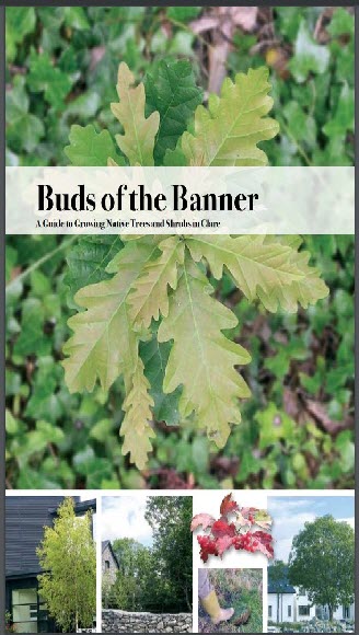
Reflecting the value of our trees to our environment, Clare County Council published a unique guide to growing native trees and shrubs in our county - Buds of the Banner [PDF,4.94MB].
National Tree Week, an initiative of The Tree Council of Ireland brings about the opportunity to promote tree awareness. Communities, associations, workgroups and family groups get together and organise lots of tree planting events, making Ireland greener! To find out about National Tree Week in Clare visit the Clare County Council website.
The Afforestation Grant and Premium Scheme incorporates 12 separate Grant and Premium Categories (GPCs), providing options including productive conifers, broadleaf species, native woodland initiatives as well as agroforestry and forestry-for-fibre options. Full details of this wide array of GPC options and associated funding are available from your Teagasc Forestry Adviser.
The Native Woodland Conservation Scheme aims to restore Ireland’s native woodland resource and associated biodiversity. The Scheme prioritises sites of high ecological significance (included ancient woodlands and designated areas such as Special Areas of Conservation) and also sites where native woodland restoration will 'deliver' benefits regarding the protection of watercourses and aquatic habitats. To find out more read the Native Woodland Scheme Framework [PDF,3.18MB].
The NeighbourWood Scheme supports the development of attractive close-to-home woodland amenities (or ‘neighbourwoods’) for public use and enjoyment. The scheme is available to both public and private landowners, working in partnership with local communities. Applications from other landowners may be considered on a case-by-case basis.
The Creation of Woodland on Public Lands Scheme aims to encourage Public Bodies to establish new native woodlands on suitable bare land and is aimed at all Public Bodies, including: (1) Government Departments and State Sponsored Organisations, (2) Higher Education Authorities and (3) Local Authorities.
Environmental Awareness Officer
The Environment Section of Clare County Council also has a role in the improvement preservation and enhancement of the environment in Clare. Under the Greener Clare Initiative, the Environmental Section work with local groups to develop environmentally sustainable initiatives.
Page last reviewed: 10/03/22
Content managed by: Heritage unit (within Planning department)
Back to topContact
Áras Contae an Chláir
New Road
Ennis
Co. Clare
V95 DXP2
(065) 684 6407
This is just for feedback on our web site, not comments or questions about our services.
To tell us about anything else, go to our contact us pages.